Portal:Scottish islands
The Scottish Islands Portal
Welcome! — Fàilte! — Walcome!

Scotland has around 900 offshore islands, most of which are to be found in four main groups: Shetland, Orkney, and the Hebrides, sub-divided into the Inner Hebrides and Outer Hebrides. There are also clusters of islands in the Firth of Clyde, Firth of Forth, and Solway Firth, and numerous small islands within the many bodies of fresh water in Scotland including Loch Lomond and Loch Maree. The largest island is Lewis and Harris which extends to 2,179 square kilometres, and there are a further 200 islands which are greater than 40 hectares in area. Of the remainder, several such as Staffa and the Flannan Isles are well known despite their small size. Some 94 Scottish islands are permanently inhabited, of which 89 are offshore islands. Between 2001 and 2011 Scottish island populations as a whole grew by 4% to 103,702.
The geology and geomorphology of the islands is varied. Some, such as Skye and Mull, are mountainous, while others like Tiree and Sanday are relatively low lying. Many have bedrock made from ancient Archaean Lewisian Gneiss which was formed 3 billion years ago; Shapinsay and other Orkney islands are formed from Old Red Sandstone, which is 400 million years old; and others such as Rùm from more recent Tertiary volcanoes. Many of the islands are swept by strong tides, and the Corryvreckan tide race between Scarba and Jura is one of the largest whirlpools in the world. Other strong tides are to be found in the Pentland Firth between mainland Scotland and Orkney, and another example is the "Grey Dog" between Scarba and Lunga. (More on Scottish islands...)
Selected picture
Selected island group
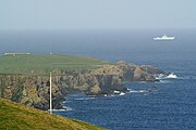
The Flannan Isles (Scottish Gaelic: Na h-Eileanan Flannach) or the Seven Hunters are a small island group in the Outer Hebrides of Scotland, approximately 32 kilometres (17+1⁄2 nautical miles) west of the Isle of Lewis. They may take their name from Saint Flannan, the 7th century Irish preacher and abbot.
The islands have been devoid of permanent residents since the automation of Flannan Isles Lighthouse in 1971. (Full article...)
News
- 12 February: The BiFab construction yard at Arnish near Stornoway, Isle of Lewis, is purchased by InfraStrata.
- 11 February: Wild fires occur in Benbecula; and at Achmore and Sildinish in the Isle of Lewis; Horsaclete in Harris; Brevig in Barra; and Eubhal in North Uist.
- 19 January: Barra and Vatersay are put under tier-4 restrictions after an outbreak of Covid-19.
- 18 January: The Shetland Space Centre submits plans for a spaceport on Unst (proposed site pictured), Shetland, including three rocket launch pads.
- 8 January: Distilleries in Orkney and South Uist receive government grants to research ways of reducing their CO2 emissions.
- 4 January: After the UK leaves the European Union, the Northern Celt, an Irish fishing boat based out of Greencastle, County Donegal, is ordered to leave the 12-nautical-mile zone around Rockall by officers of Marine Scotland.
- 1 January: A total of 72 cases of Covid-19 are recorded in an ongoing outbreak in Shetland.
- 9 December: A review by a committee of MSPs into the commissioning and building of two new dual-fuel Caledonian MacBrayne ferries, MV Glen Sannox and "hull 802", criticises CMAL, Transport Scotland and the Scottish government, as well as the ship builders, Ferguson Marine.
- 3 December: North-east Lewis, Sea of the Hebrides and Shiant East Bank are designated Marine Protected Areas, while East Mainland Coast Shetland, Sound of Gigha, Coll and Tiree, Rùm, the west coast of the Outer Hebrides, and the waters off St Kilda and Foula are designated Special Protection Areas.
- 30 November: Michael Russell, MSP for Argyll and Bute, and David Stewart and John Finnie, MSPs for the Highlands and Islands region, will stand down at the 2021 election.
- 17 November: Phytophthora ramorum-infected larch trees in Arran are to be felled over a 543-acre area, to prevent the fungus-like pathogen from spreading.
- 4 November: The Scottish Wildlife Trust objects to a proposed salmon farm in the Marine Protected Area of Wester Ross, near Horse Island, Summer Isles, because of the potential impact on kelp forests and maerl beds.
Selected fauna
The Atlantic puffin (Fratercula arctica), also known as the common puffin, is a species of seabird in the auk family. It is the only puffin native to the Atlantic Ocean; two related species, the tufted puffin and the horned puffin are found in the northeastern Pacific. The Atlantic puffin breeds in Russia, Iceland, Ireland, Britain, Norway, Greenland, Newfoundland and Labrador, Nova Scotia, and the Faroe Islands, and as far south as Maine in the west and France in the east. It is most commonly found in the Westman Islands, Iceland. Although it has a large population and a wide range, the species has declined rapidly, at least in parts of its range, resulting in it being rated as vulnerable by the IUCN. On land, it has the typical upright stance of an auk. At sea, it swims on the surface and feeds on zooplankton, small fish, and crabs, which it catches by diving underwater, using its wings for propulsion.
This puffin has a black crown and back, pale grey cheek patches, and a white body and underparts. Its broad, boldly marked red-and-black beak and orange legs contrast with its plumage. It moults while at sea in the winter, and some of the brightly coloured facial characteristics are lost, with colour returning during the spring. The external appearances of the adult male and female are identical, though the male is usually slightly larger. The juvenile has similar plumage, but its cheek patches are dark grey. The juvenile does not have brightly coloured head ornamentation, its bill is narrower and is dark grey with a yellowish-brown tip, and its legs and feet are also dark. Puffins from northern populations are typically larger than in the south and these populations are generally considered a different subspecies.
Spending the autumn and winter in the open ocean of the cold northern seas, the Atlantic puffin returns to coastal areas at the start of the breeding season in late spring. It nests in clifftop colonies, digging a burrow in which a single white egg is laid. Chicks mostly feed on whole fish and grow rapidly. After about 6 weeks, they are fully fledged and make their way at night to the sea. They swim away from the shore and do not return to land for several years.
Colonies are mostly on islands with no terrestrial predators, but adult birds and newly fledged chicks are at risk of attacks from the air by gulls and skuas. Sometimes, a bird such as an Arctic skua or blackback gull can cause a puffin arriving with a beak full of fish to drop all the fish the puffin was holding in its mouth. The puffin's striking appearance, large, colourful bill, waddling gait, and behaviour have given rise to nicknames such as "clown of the sea" or "sea parrot". It is the official bird of the Canadian province of Newfoundland and Labrador. (Full article...)
Selected history & culture article

Dál Riata or Dál Riada (also Dalriada) (/dælˈriːədə/) was a Gaelic kingdom that encompassed the western seaboard of Scotland and north-eastern Ireland, on each side of the North Channel. At its height in the 6th and 7th centuries, it covered what is now Argyll ("Coast of the Gaels") in Scotland and part of County Antrim in Northern Ireland. After a period of expansion, Dál Riata eventually became associated with the Gaelic Kingdom of Alba.
In Argyll, it consisted of four main kindreds or tribes, each with their own chief: Cenél nGabráin (based in Kintyre), Cenél nÓengusa (based on Islay), Cenél Loairn (who gave their name to the district of Lorn) and Cenél Comgaill (who gave their name to Cowal). The hillfort of Dunadd is believed to have been its capital. Other royal forts included Dunollie, Dunaverty and Dunseverick. Within Dál Riata was the important monastery of Iona, which played a key role in the spread of Celtic Christianity throughout northern Britain, and in the development of insular art. Iona was a centre of learning and produced many important manuscripts. Dál Riata had a strong seafaring culture and a large naval fleet.
Dál Riata is said to have been founded by the legendary king Fergus Mór (Fergus the Great) in the 5th century. The kingdom reached its height under Áedán mac Gabráin (r. 574–608). During his reign Dál Riata's power and influence grew; it carried out naval expeditions to Orkney and the Isle of Man, and assaults on the Brittonic kingdom of Strathclyde and Anglian kingdom of Bernicia. However, King Æthelfrith of Bernicia checked its growth at the Battle of Degsastan in 603. Serious defeats in Ireland and Scotland during the reign of Domnall Brecc (died 642) ended Dál Riata's "golden age", and the kingdom became a client of Northumbria for a time. In the 730s the Pictish king Óengus I led campaigns against Dál Riata and brought it under Pictish overlordship by 741. There is disagreement over the fate of the kingdom from the late 8th century onwards. Some scholars have seen no revival of Dál Riatan power after the long period of foreign domination (c. 637 to c. 750–760), while others have seen a revival under Áed Find (736–778). Some even claim that the Dál Riata usurped the kingship of Fortriu. From 795 onward there were sporadic Viking raids in Dál Riata. In the following century, there may have been a merger of the Dál Riatan and Pictish crowns. Some sources say Cináed mac Ailpín (Kenneth MacAlpin) was king of Dál Riata before becoming king of the Picts in 843, following a disastrous defeat of the Picts by Vikings. The kingdom's independence ended sometime after, as it merged with Pictland to form the Kingdom of Alba.
Latin sources often referred to the inhabitants of Dál Riata as Scots (Scoti), a name originally used by Roman and Greek writers for the Irish Gaels who raided and colonised Roman Britain. Later, it came to refer to Gaels, whether from Ireland or elsewhere. They are referred to herein as Gaels or as Dál Riatans. (Full article...)
Selected island
Dubh Artach (/duː ˈɑːrtɑːx/; Scottish Gaelic: [t̪uh ˈarˠʃt̪əx]) is a remote skerry of basalt rock off the west coast of Scotland lying 18 miles (29 km) west of Colonsay and 15 miles (24 km) south-west of the Ross of Mull.
A lighthouse designed by Thomas Stevenson with a tower height of 145 feet (44 m) was erected between 1867 and 1872 with a shore station constructed on the isle of Erraid. The rock is subject to extraordinary sea conditions with waves of 92 feet (28 m) or more being encountered by the keepers. Despite these adverse conditions several men served the light for lengthy periods until it was automated in 1971. Dubh Artach is the official name of the lighthouse, although the skerry itself is also known as Dhu Heartach. Various interpretations have been provided for the original meaning of the Gaelic name, of which "The Black Rock" is the most likely. (Full article...)
Did you know?
- ... that in 1905, Scottish photographer Robert M. Adam (pictured) was among the last to photograph Mingulay island before it was abandoned?
- ... that Shetland sheep have 30 different recognised coat patterns?
- ... that in a single week in 1992, a four-man team including Mick Fowler and Andy Nisbet climbed all the main stacks of the Drongs?
- ... that Shetlander Johnnie Notions, a physician with no formal medical background, developed a smallpox inoculation that successfully immunised thousands of people before Jenner's vaccine was available?
Selected portrait
Selected geography article
The Cuillin (Scottish Gaelic: An Cuiltheann) is a range of mostly jagged rocky mountains on the Isle of Skye in Scotland. The main Cuillin ridge is also called the Black Cuillin to distinguish it from the Red Cuillin (na Beanntan Dearga), which lie to the east of Glen Sligachan.
The peaks of the Black Cuillin are mainly composed of gabbro, a very rough igneous rock which provides a superb grip for mountaineers; and basalt, which can be very slippery when wet. The rocks forming the ridge of the Black Cuillin (and outliers such Blà Bheinn) are dark, particularly in the shade, but when in sunlight the Black Cuillin can appear grey to brown. The main ridge forms a narrow crest, with steep cliffs and scree slopes. The ridge is about 14 kilometres (8+1⁄2 miles) long (from Gars-bheinn in the south to Sgùrr nan Gillean in the northeast), and curves in an irregular semi-circle around Loch Coruisk, which lies at the heart of the range. The highest point of the Cuillin, and of the Isle of Skye, is Sgùrr Alasdair in the Black Cuillin at 992 m (3,255 ft).
The Red Cuillin are mainly composed of granite, which is paler than the gabbro (with a reddish tinge from some angles in some lights) and has weathered into more rounded hills with vegetation cover to summit level and long scree slopes on their flanks. These hills are lower and, being less rocky, have fewer scrambles or climbs. The highest point of the red hills is Glamaig at 775 m (2,543 ft), one of only two Corbetts on Skye (the other being Garbh-bheinn, part of the small group of gabbro outliers surrounding Blà Bheinn).
The scenic beauty of the Cuillin has led to it being designated a national scenic area, one of forty such areas in Scotland. A Scottish Natural Heritage review of the special qualities of the Cuillin stated:
(Full article...)The mountains rise up dramatically from the sea creating formidable, enclosed sea lochs, with the absence of foothills enhancing their vast scale. Many iconic views of Scotland are centred here, whether Sgurr nan Gillean soaring above Sligachan, Loch Scavaig and the Cuillin ridge from Elgol, or Bla Bheinn above Torrin.
— Scottish Natural Heritage
Selected biography

Patrick Stewart, 2nd Earl of Orkney, known as Black Patie, had control of Orkney in 1594 at the time of Balfour's trial. Patie was convinced that his younger brothers, especially John Stewart, Earl of Carrick, were plotting to kill him. Patie discovered poison in the possession of one of John's servants, Thomas Paplay, who after being tortured for eleven days confessed and implicated Balfour among his co-conspirators.
Although Paplay retracted his confession just before his execution, Balfour and her family were transported to Kirkwall, where they were tortured until a confession was extracted. Balfour was tried, found guilty of witchcraft, and sentenced to death. Just as Paplay had done, Balfour retracted her confession immediately before her execution on 16 December 1594, publicly proclaiming her innocence and detailing the tortures carried out on her and members of her family. She was executed at Gallow Ha' in Kirkwall on 16 December 1594. (Full article...)
Related portals
Selected panorama
Topics
Categories
The main category is Islands of Scotland, with subcategories

Things you can do
- Add new articles to the project by placing {{WPSI|class=|importance=}} on the talk page
- Add a link to the portal in the "See also" section of relevant articles with {{Portal|Scottish islands}}
- Take requested photographs or create requested pages, including Prehistoric Hebrides, Trialabreac, Dog Isle...
- Expand a Scottish Islands stub into a full article, adding images, citations, references and infoboxes; did you know that if you expand one 5x, you can nominate it for Did You Know?
- Improve one of the highest priority articles, including Mull, Bute, North & South Uist, Columba, Highland Clearances, Sorley MacLean, St Magnus Cathedral...
- Follow these hints to improve a B-class article and nominate it for Good Article

- Suggest articles, pictures, interesting facts, events and news to be featured here on the portal
Wikiproject
Associated Wikimedia
The following Wikimedia Foundation sister projects provide more on this subject:
-
Commons
Free media repository -
Wikibooks
Free textbooks and manuals -
Wikidata
Free knowledge base -
Wikinews
Free-content news -
Wikiquote
Collection of quotations -
Wikisource
Free-content library -
Wikiversity
Free learning tools -
Wikivoyage
Free travel guide -
Wiktionary
Dictionary and thesaurus


